
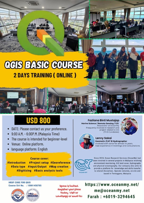
QGIS Online Course
This online class will introduce to beginners on how to register the image. QGIS Georeferencer is a tool for generating world files for layers. It allows you to reference rasters or vectors to geographic or projected coordinate systems by creating a new GeoTiff or by adding a world file to the existing file. The basic approach to georeferencing a layer is to locate points on it for which you can accurately determine coordinates.
The following subjects are dealt with:
Introduction to GIS and its importance
Understanding the basic concepts: Coordinate systems, projections, and data formats.
Basic QGIS Operations: Navigating the QGIS interface, Creating and managing projects.
Working with Raster Data.
Basic Data editing.
Introduction to Spatial Analysis
Basic mapping and data visualization.
Etc.
Address
Ocean Research Services / Ocean My Level 1, DUA, Dapo Pata Tok Jembal, Jalan Longgok, 21300 Kuala Nerus, Terengganu Darul Iman
Email us at
me@oceanmy.net
Phone/Whatsapp
Yana (+6013 400 9856)
Farah (+6019 329 4645)
Contact Us